

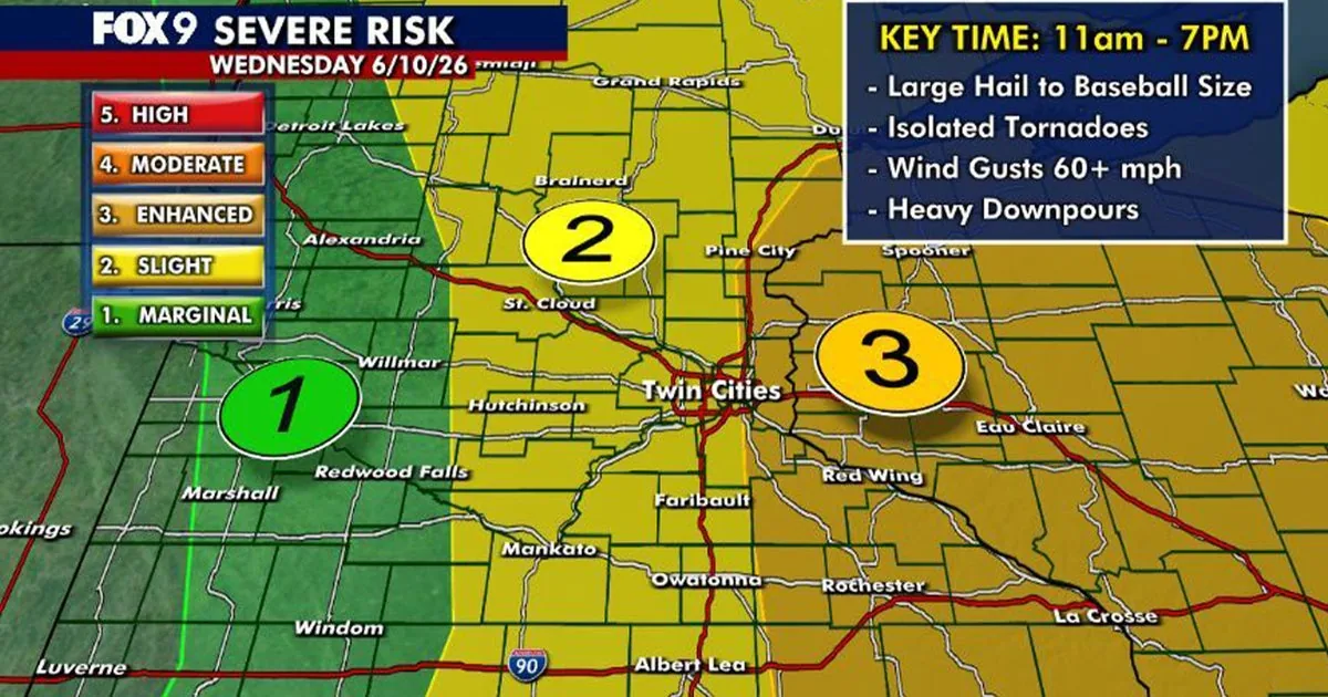
MINNEAPOLIS, MN — Forecasters say Minnesota is likely to get another round of potentially severe storms Wednesday after overnight thunderstorms moved out early in the day. The National Weather Service has issued a Severe Thunderstorm Watch for far southeastern Minnesota, much of Wisconsin, and parts of Iowa, with the watch set to run until 7 p.m. Wednesday.
The timing gives the Twin Cities a quiet stretch through the mid-morning, but storm chances return later as temperatures climb quickly into the upper 80s and the heat index reaches the mid-90s.
Watch Area and Timing
In Minnesota, the watch includes Fillmore, Goodhue, Houston, Olmsted, Wabasha, and Winona counties. In Wisconsin, the watch covers most of the state except for some northern counties, while eastern Iowa counties along the Wisconsin and Illinois border are also included.
Forecasters expect the next round of storms to develop from late morning through the afternoon and evening, with the most active window running roughly from 11 a.m. to 7 p.m.
Severe Weather Hazards
The storms that moved through earlier Wednesday brought heavy rain, strong winds, lightning, and some power outages across parts of Minnesota. The new round could again turn strong or severe as the atmosphere recharges during the day.
All severe weather hazards remain on the table, including baseball-size hail, damaging winds, and tornadoes. The level 3 enhanced risk stretches across eastern Minnesota and western Wisconsin, with lower risk categories farther west in Minnesota.
What Minnesota Can Expect
The Twin Cities metro should stay dry through the morning before storm chances build again later in the day. After sunset, storm activity is expected to fade, and overnight lows should settle into the mid-60s.
Areas farther west in Minnesota are under a level 1 marginal risk, while central Minnesota sits in a level 2 slight risk. That means storm coverage and intensity will depend on where storms can form later Wednesday.
Cooler Weather Ahead
Thursday is expected to be cooler, with highs in the mid-70s and a few scattered showers possible along with breaks of sunshine. Friday should warm back into the low 80s before another cold front moves in late in the day.
The weekend forecast looks more comfortable, with sunshine and highs in the mid-70s. Forecasters say a stray storm cannot be ruled out on Friday, but no widespread severe weather is expected in the short-term outlook.
Grab a cup – Coffee Green Bay has your Wisconsin news ready.
Leave a Reply